Overview
- Adopting conservation practices on environmentally sensitive croplands can have big benefits for the climate and water quality.
- In counties in the Mississippi River region with farmed wetland acres, between 2017 and 2020, only 36 percent of funding from a major Department of Agriculture conservation program went to practices that would have such benefits.
- The region’s counties with the most environmentally sensitive wetland farmed acres did not receive a commensurate portion of such funding.
The 13-state Mississippi River Critical Conservation Area, or MRCCA, has millions of environmentally sensitive acres that are full of opportunity to adopt conservation practices that can improve water quality and fight the climate crisis – but insufficient federal funding currently stands in the way.
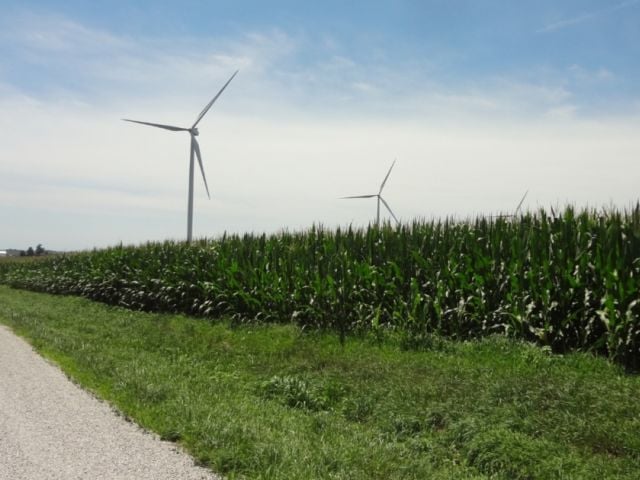
In many places in the Midwest, environmentally sensitive lands, like wetlands, are planted with crops. These parcels are more prone to flooding and soil loss, and they’re usually less productive than prime farmland. These lands are also more likely to experience runoff and therefore to contribute nitrogen and phosphorus pollution to waterways, and are more vulnerable to the climate crisis.
But the flip side is also true: Agricultural conservation practices implemented in these areas play an outsize role in benefitting climate change mitigation and resilience, as well reducing nutrient pollution.
In theory, federal conservation programs provide funding to farmers for exactly this purpose. But a new EWG analysis finds a key Department of Agriculture conservation program allocates too little funding to environmentally sensitive lands in one of the most important agricultural areas in the country – the MRCCA, which spans more than 1,000 counties in 13 states. The program is known as the Environmental Quality Incentives Program, or EQIP.
EWG has compiled a list of EQIP-funded practices it has designated climate- and nutrient-smart, since they help lower nutrient pollution and greenhouse gas emissions. EWG’s research finds that even though some counties in the MRCCA had more environmentally sensitive land than others, they didn’t receive more relevant conservation funding than counties with less environmentally sensitive land.
In fact, in MRCCA counties with a specific type of sensitive cropland, only 36 percent of the more than $519.6 million in EQIP funding spent between 2017 and 2020 went to conservation practices that mitigate climate change or reduce nutrient pollution to surface water or groundwater.
And in these counties, many of the EQIP practices that received the most money were neither climate- nor nutrient-smart. Instead, much of the money went to structural, equipment or facility practices that neither benefit the climate nor reduce nutrient pollution.
Taxpayers can get more bang for their EQIP buck if the right conservation practices are funded and applied on sensitive lands used to grow crops. These areas are promising for conservation. Congress should expand and reform EQIP to prioritize funding for climate- and nutrient-smart practices and reduce funding for structural, equipment and facility practices that do not provide climate and nutrient runoff benefits.
‘Potential wetland soil landscapes’ in the MRCCA are often farmed
The MRCCA is a region encompassing 1,047 counties in 13 states – Arkansas, Illinois, Indiana, Iowa, Kentucky, Louisiana, Minnesota, Mississippi, Missouri, Ohio, South Dakota, Tennessee and Wisconsin. It provides vital wildlife habitat and other ecological resources, such as recreational waters.
The region also covers much of the Corn Belt and other agriculturally important areas. It’s responsible for a considerable portion of U.S. agricultural greenhouse gas emissions and polluted farm runoff that enters major waterways like the Mississippi River and Gulf of Mexico.
In the MRCCA, millions of acres of environmentally sensitive land are used as cropland. This marginal land is more prone to environmental problems like nutrient runoff and soil erosion and more vulnerable to climate change than the most productive cropland.
In a previous report and interactive map, EWG calculated how many cropland acres exist in the MRCCA on four types of environmentally sensitive landscapes: highly erodible land, 100-year floodplains, riparian corridors, and potential wetland soil landscapes, or PWSL.
PWSLs are areas of cropland that have hydric soil, which is soil that is sometimes or frequently saturated with water. There are over 33 million cropped acres of this type in the MRCCA. The USDA Natural Resources Conservation Service defines PWSL as areas that are hydric, poorly drained or flooded (see our Methodology below for more information). Many were once likely wetlands and converted into cropland many decades ago.
Putting conservation practices on farmed wetlands can effect sizable environmental changes by reducing the phosphorus and nitrogen running off farm fields. In turn, this can help curtail algae blooms and decrease the amount of nitrate that ends up in drinking water – both of which can have significant implications for public health.
Research commissioned by the USDA shows converting PWSL back into wetlands can reduce greenhouse gas emissions: “[T]he practice results in significant carbon sequestration and reduces on-site emissions associated with commodity production, producing an overall net mitigation of GHG emissions.”
The more than 33 million acres of PWSL cropland in the MRCCA represent some of the most promising opportunities to reduce nutrient runoff and climate emissions, if the right agricultural conservation practices are funded and adopted.
EQIP doesn’t fund the right practices in MRCCA counties with environmentally sensitive cropland
Almost one-quarter of all MRCCA cropland is on PWSL. Each of the 13 states in the region contains PWSL cropland; 943 of all 1,047 counties have at least some PWSL cropland acres. But just three states – Illinois, Iowa and Minnesota – contain half of all the acres of PWSL cropland in the region.
Of the 943 counties, 871, or 92 percent, received a total of $519.6 million in EQIP funding between 2017 and 2020. But this is likely an undercount of total EQIP spending.
From USDA Freedom of Information Act requests fulfilled in the summer of 2022, EWG only received county-level EQIP payment data for practices that had more than five contracts in a county in a year. Because of “privacy concerns,” we were not given total county-level EQIP funding for every practice, so actual EQIP payments for the MRCCA counties are likely larger than this amount. This data can be found in EWG’s Conservation Database. Since the data represents practices that had more than five contracts in a county per year, they show which practices are the most frequently adopted and which are not.
Of the total EQIP payments made in MRCCA counties with PWSL cropland, only 36 percent, or $186.9 million, went to practices that reduce greenhouse gas emissions and nutrient pollution to surface water or groundwater, according to EWG’s analysis of climate- and nutrient-smart EQIP practices.
EWG’s interactive map shows the 943 MRCCA counties with crops grown on PWSL acres, total EQIP spending between 2017 and 2020 in the 871 counties that received payments, and EQIP spending on climate- and nutrient-smart practices in the 720 counties that received climate- and nutrient- smart funding. The map also provides the three EQIP practices with the most funding in each county, if they were identified in the USDA data.

This map shows the 1,047 counties in the Mississippi River Critical Conservation Area, or MRCCA, located in 13 states: Arkansas, Illinois, Indiana, Iowa, Kentucky, Louisiana, Minnesota, Mississippi, Missouri, Ohio, South Dakota, Tennessee and Wisconsin.
In the counties with PWSL land that received EQIP funding, just 10 EQIP practices out of more than 100 received 61 percent of all EQIP payments. Almost all of these were structural, equipment or facility practices, which are not very beneficial for the climate or nutrient pollution reduction – and can even be detrimental for one or both. Eight of the top 10 practices fit into this category, totaling over $159.6 million, or 50 percent of the spending going to the top 10 practices (Table 1). Cover crops and irrigation land leveling were the two non-structural, equipment or facility practices.
Table 1. The 10 practices with the most EQIP funding between 2017 and 2020 to the MRCCA counties with PWSL cropland and EQIP payments
| Rank | Practice | EQIP spending 2017 to 2020 | Climate- or nutrient-smart practice? |
|---|---|---|---|
| 1 | Cover Crop | $145,594,982 | Yes |
| 2 | Irrigation Pipeline | $32,141,172 | No |
| 3 | Fence | $32,139,075 | No |
| 4 | Grade Stabilization Structure | $22,516,235 | No |
| 5 | Grade Stabilization Structure | $19,450,570 | No |
| 6 | Irrigation Land Leveling | $14,256,052 | No |
| 7 | Heavy Use Area Protection | $14,026,183 | No |
| 8 | Livestock Pipeline | $13,724,670 | No |
| 9 | Streambank and Shoreline Protection | $13,321,352 | No |
| 10 | Roofs and Covers | $12,296,421 | No |
Source: EWG, from public records requests of USDA-NRCS Environmental Quality Incentives Program data and the USDA’s Natural Resources Conservation Service SSURGO Database.
The practice that received the most funding – cover crops – is a climate- and nutrient-smart practice, but it was the only such practice in the top 10. Over $145.5 million in EQIP spending, representing more than a quarter of the funding for all practices in PWSL counties, went to cover crops.
Cover crops received 78 percent of all EQIP spending for EWG climate-smart practices in PWSL counties. This means the other 17 climate- and nutrient-smart practices funded in PWSL counties received only $41.3 million, or 22 percent, of all money spent on climate- and nutrient-smart practices.
Although the program is doing a good job of funding cover crops in the MRCCA, more money needs to be spent on other EQIP practices that also have climate and nutrient benefits.
EQIP also funds practices that actually increase greenhouse gas emissions on PWSL crop acres in the MRCCA. The practice “Waste storage facility,” which by the USDA’s own reckoning produces greenhouse gasses, ranked 13th for most EQIP payments between 2017 and 2020, garnering almost $11.1 million.
Counties with the most PWSL acres don’t get enough EQIP funding
To maximize nutrient reduction and climate benefits, MRCCA counties with the most PWSL cropland acres should be a priority for EQIP funding for climate- and nutrient-smart practices. Yet when we analyzed EQIP spending for all conservation practices, we found that the counties with the most PWSL acres did not receive the most EQIP funding between 2017 and 2020.
They didn’t even receive proportionate funding. The top 100 counties with the most PWSL cropland acres in the MRCCA made up almost half of all PWSL acres in the region, but received only 19 percent of total EQIP payments between 2017 and 2020.
The top 10 counties with the most PWSL cropland have, collectively, almost 3 million such acres. Of these, Sunflower and Bolivar counties in Mississippi had the most and second-most EQIP payments of all PWSL counties. But the rest of the counties in the top 10 received hardly any EQIP funding. Sunflower and Bolivar Counties alone made up 91 percent of all EQIP payments to these counties. The other eight counties received only $4 million out of almost $43.5 million (Table 2).
Table 2. The 10 counties with the most PWSL crop acres in the MRCCA
| County | State | PWSL crop acres | Rank of PWSL crop acres | Total 2017-2020 EQIP spending | EQIP spending rank, out of 871 counties |
|---|---|---|---|---|---|
| Iroquois | Illinois | 356,770 | 1 | $351,039 | 367 |
| Livingston | Illinois | 302,520 | 2 | $391,076 | 345 |
| Renville | Minnesota | 301,615 | 3 | $627,422 | 244 |
| Bolivar | Mississippi | 284,753 | 4 | $16,783,696 | 2 |
| Kossuth | Iowa | 274,721 | 5 | $137,388 | 592 |
| New Madrid | Missouri | 273,178 | 6 | $1,749,105 | 63 |
| Sunflower | Mississippi | 266,148 | 7 | $22,647,296 | 1 |
| Redwood | Minnesota | 262,240 | 8 | $397,269 | 342 |
| Champaign | Illinois | 260,965 | 9 | $52,900 | 757 |
| Audrain | Missouri | 252,966 | 10 | $318,773 | 396 |
Source: EWG, from public records requests of USDA-NRCS Environmental Quality Incentives Program data and the USDA’s Natural Resources Conservation Service SSURGO Database
Environmentally sensitive crop acres are promising opportunities for conservation
Environmentally sensitive land used to grow crops can provide promising opportunities for conservation practices to make a big impact on reducing nutrient pollution to water, lowering greenhouse gas emissions and improving climate change resiliency. Sensitive land is often more vulnerable to nutrient runoff and climate impacts, so if these susceptible areas are going to continue to be farmed, the conservation practices that are right for them should be funded and adopted.
Conservation programs must fund the right practices in the right places to get the biggest climate and nutrient pollution reduction benefits.
Reforming EQIP could take advantage of these opportunities. Congress should update EQIP to make climate a top priority by:
- Expanding and reforming the program to make climate the primary purpose of its incentive contracts.
- Providing 90 percent cost-share only for EQIP practices that reduce greenhouse gas emissions.
- Reducing federal cost-sharing for structural, equipment and facility practices that provide few or no environmental benefits.
- Prohibiting EQIP spending on practices that increase greenhouse gas emissions.
Although this analysis investigates EQIP funding, money from the USDA’s Conservation Stewardship Program, or CSP, also must focus more on climate-smart practices.
However, we could not conduct a similar analysis for CSP due to the poor quality data on county-level payments by practice we received in response to our FOIA requests. The majority of CSP payments were categorized by land use like cropland or pasture, so we cannot know exactly which practices and enhancements most of the CSP funding went to.